Map of the Orinoco region
The Orinoco region is broader speaking the areas located on the banks of the Casanare, Meta, Apure, Vichada and Orinoco rivers.
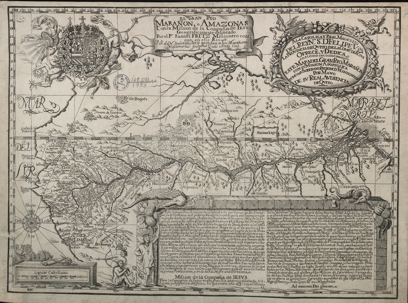
During the colonial period, Jesuits missionaries started their incursions in the area from 1628 until their expulsion of the Spanish colonies in 1767. Some jesuits described the area and drew maps of the region during this time. This is an example:
Map projects
Map on missions established by religious orders (Jesuits, Dominicans, Franciscans, Capuchins, and Augustinians) in the New Kingdom of Granada during the eighteenth century.
Image: El gran río Marañón o Amazonas. Samuel Fritz, S.J., 1707